 |
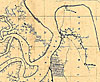
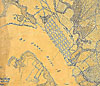
Map
of Fernandina and Fort Clinch from the 1860s. |
 |
Detailed
view of Ft. Clinch from 1863. |
 |
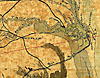
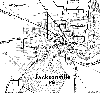
Detailed
view of Jacksonville from 1863. |
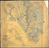 |
Map
of Jacksonville and its vicinity from 1864. |
 |
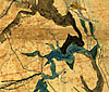
Detailed
view of Jacksonville from 1864. |
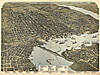 |
Perspective
map of Jacksonville from 1893. |
 |
Detailed
view of wharves and a bridge in Jacksonville from 1893. |
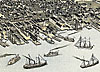 |
Detailed
view of wharves and ships in Jacksonville from 1893. |
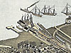 |
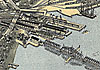
Detailed
view of ships and a railroad in Jacksonville from 1893. |
|
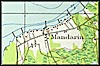
1917, Mandarin, Florida. Detail view from a United States Geological
Survey map |
|
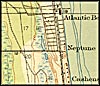
1918, Atlantic Beach, Florida. Detail view from a United States
Geological Survey map |
|
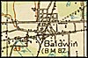
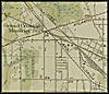
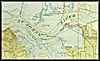
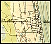
1918, Baldwin, Florida. Detail view from a United States Geological
Survey map |
|
1918, Brooklyn & Highway, Florida. Detail view from a United
States Geological Survey map |
|
1918, Grand Crossing Moncrief Sta, Florida. Detail view from a United
States Geological Survey map |
|
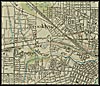
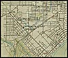
1918, Greater Jacksonville, Florida. Detail view from a United States
Geological Survey map |
|
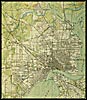
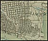
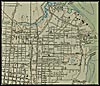
1918, Jacksonville, Florida. Detail view from a United States Geological
Survey map |
|
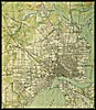
1918, Jacksonville Center, Florida. Detail view from a United States
Geological Survey map |
|
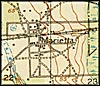
1918, Marietta, Florida. Detail view from a United States Geological
Survey map |
|
1918, Mayport, Florida. Detail view from a United States Geological
Survey map |
|
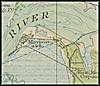
1918, Mouth of St Johns River, Florida. Detail view from a United
States Geological Survey map |
|
1918, Murray Hill, Florida. Detail view from a United States Geological
Survey map |
|
1918, New Springfield, Florida. Detail view from a United States
Geological Survey map |
|
1918, Pabla Beach, Florida. Detail view from a United States Geological
Survey map |
|
1918, Panama Park & Phoenix Park, Florida. Detail view from
a United States Geological Survey map |
|
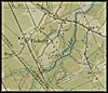
1918, Pickett, Florida. Detail view from a United States Geological
Survey map |
|
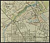
1918, Pride City & Brentwood, Florida. Detail view from a United
States Geological Survey map |
|
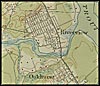
1918, Riverview & Oakhurst, Florida. Detail view from a United
States Geological Survey map |
|
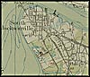
1918, South Jacksonville & Philips, Florida. Detail view from
a United States Geological Survey map |
|
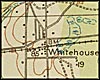
1918, Whitehouse, Florida. Detail view from a United States Geological
Survey map |
 |
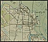
Street
map of Jacksonville in 1920. |