|
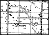
1940, Allentown, Florida. Detail view from a Florida State Road Department general highway and transportation map. |
|
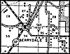
1940, Berrydale, Florida. Detail view from a Florida State Road Department general highway and transportation map. |
|
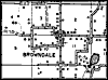
1940, Browndale, Florida. Detail view from a Florida State Road Department general highway and transportation map. |
|
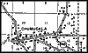
1940, Chumuckla, Florida. Detail view from a Florida State Road Department general highway and transportation map. |
|
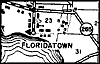
1940, Floridatown, Florida. Detail view from a Florida State Road Department general highway and transportation map. |
|
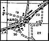
1940, Harold, Florida. Detail view from a Florida State Road Department general highway and transportation map. |
|
1940, Holly, Florida. Detail view from a Florida State Road Department general highway and transportation map. |
|
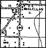
1940, McClellan, Florida. Detail view from a Florida State Road Department general highway and transportation map. |
|
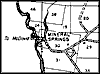
1940, Mineral Springs, Florida. Detail view from a Florida State Road Department general highway and transportation map. |
|
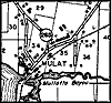
1940, Mulat, Florida. Detail view from a Florida State Road Department general highway and transportation map. |
|
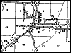
1940, Munson, Florida. Detail view from a Florida State Road Department general highway and transportation map. |
|
1940, New York, Florida. Detail view from a Florida State Road Department general highway and transportation map. |
|
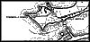
1940, Pensacola Shores and Gulf Breeze, Florida. Detail view from a Florida State Road Department general highway and transportation map. |
|
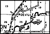
1940, Roeville, Florida. Detail view from a Florida State Road Department general highway and transportation map. |
|
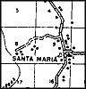
1940, Santa Maria, Florida. Detail view from a Florida State Road Department general highway and transportation map. |
|
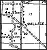
1940, Wallace, Florida. Detail view from a Florida State Road Department general highway and transportation map. |
|
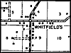
1940, Whitfield's, Florida. Detail view from a Florida State Road Department general highway and transportation map. |
|
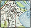
1941, Bagdad, Florida. Detail view from a United States Geological
Survey map |
|
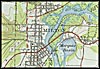
1941, Milton, Florida. Detail view from a United States Geological
Survey map |