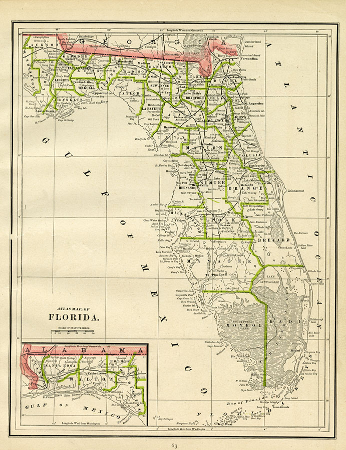
Description: A map of Florida showing county lines current to 1886, including each county seat and major towns. The railroad system extends only as far south as Tampa on the Gulf Coast, Bartow in Central Florida, and Titusville on the Atlantic Coast. Major rivers and wetlands are shown as well as relatively detailed information of the coastline, the Florida Keys, and barrier islands. Longitude is shown as west from Greenwich at the top of the map and west of Washington at the bottom of the map. The western panhandle (approximately west of the Apalachicola River) is shown on an inset map.
Place Names: 1880-1899, Cape Canaveral, �Miami, �Key West, �Pensacola, �Daytona Beach, �Gainesville, �Jacksonville, �Orlando, �Saint Augustine, �Sarasota, �Tallahassee, �Tampa, �Fort Pickens, �Milton, �Apalachicols, �Ocala, �Punta Rassa, �Brooksville,
ISO Topic Categories: boundaries, �inlandWaters, �oceans, �transportation
Keywords: Atlas Map of Florida, physical, �political, �transportation, physical features, major political subdivisions, �county borders, railroads, boundaries, �inlandWaters, �oceans, �transportation, Unknown,�Transverse_Mercator, 1886
Source: George F. Cram, (Chicago, IL: Geo. F. Cram, 1886) 63
Map Credit: Courtesy the private collection of Roy Winkelman |
|