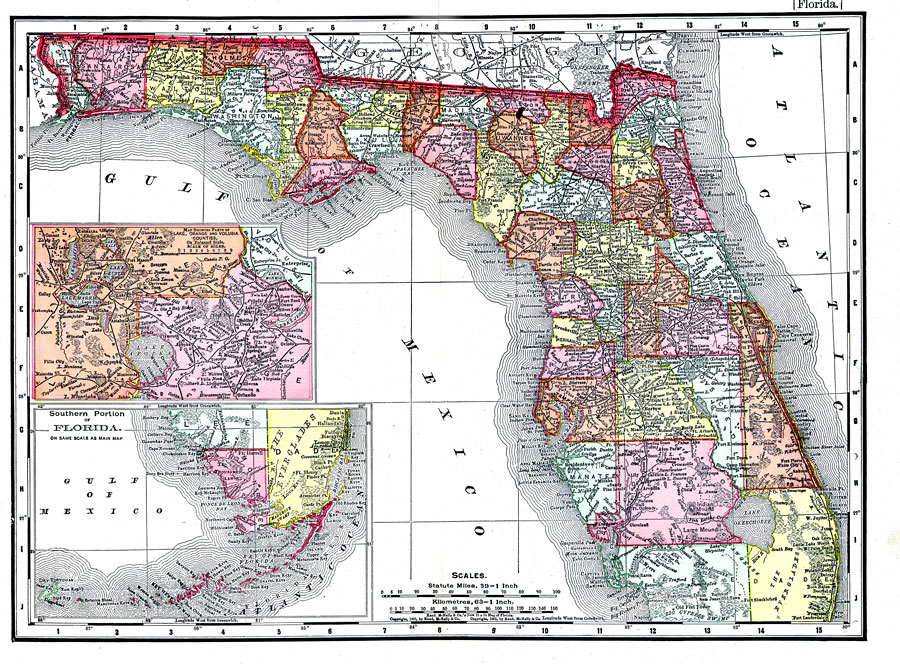
Description: This map of Florida outlines the county boundaries and railroads connecting the major cities, current in 1895. The upper most inset map illustrates the intersection of Lake, Orange and Volusia counties on an enlarged scale. This inset map also conveys the relative proximity of the large lakes in the region. The lower right inset map illustrates the southern portion of Florida, more specifically the Florida Keys, which are a part of Monroe County.
Place Names: 1880-1899, Daytona Beach, Tampa, Saint Augustine, Pensacola, Deland, Ocala, Bartow, Miami, Inverness, Sarasota, Fort Myers, Fort Lauderdale, Tallahassee, Naples, Jacksonville, Gainesville, Cape Canaveral, Orlando, Key West, St Petersburg
ISO Topic Categories: boundaries, society, transportation
Keywords: Florida, political, transportation, county borders, railroads, boundaries, society, transportation, Unknown,1895
Source: Rand, McNally & Co., The Encyclopedia Britannica Vol. IX (New York, NY: The Werner Company, 1903) 338
Map Credit: Courtesy the private collection of Roy Winkelman. |
|