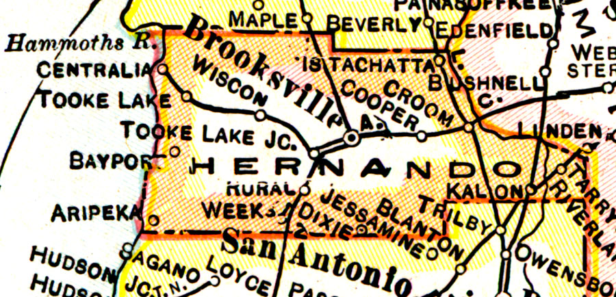
Description: A map of Hernando County showing county lines, the county seat (Brooksville), and railroads connecting the major cities current to 1921.
Place Names: Hernando, Istachatta, Croom, Cooper, Wiscom, Tooke Lake, Brooksville, Centralia, Bayport, Rerdell
ISO Topic Categories: boundaries, inlandWaters, oceans, transportation
Keywords: Hernando County, physical, political, transportation, physical features, county borders, railroads, boundaries, inlandWaters, oceans, transportation, Unknown,1921
Source: George F. Cram, (Chicago, IL: George F. Cram Company, 1921) 46
Map Credit: Courtesy the private collection of Roy Winkelman. |
|