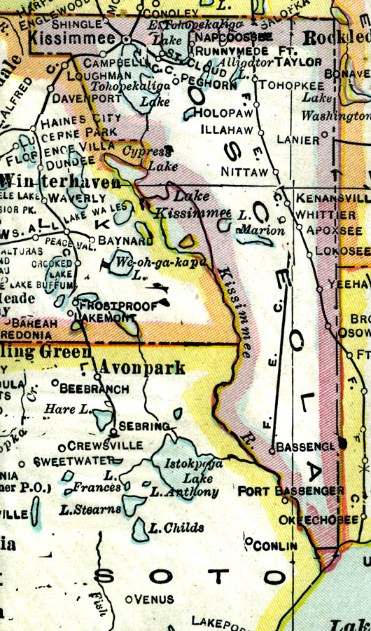
Description: A map of Osceola County showing county lines, the county seat (Kissimmee), and railroads connecting the major cities current to 1921.
Place Names: Osceola, Kissimmee, Campbell, St. Cloud, Peghorn, Narcoossee, Runnymead, Tohopkee, Holopaw, Illahaw, Nittaw, Kenansville, Apoxsee
ISO Topic Categories: boundaries, inlandWaters, transportation
Keywords: Osceola County, physical, political, transportation, physical features, county borders, railroads, boundaries, inlandWaters, transportation, Unknown,1921
Source: George F. Cram, (Chicago, IL: George F. Cram Company, 1921) 46
Map Credit: Courtesy the private collection of Roy Winkelman. |
|