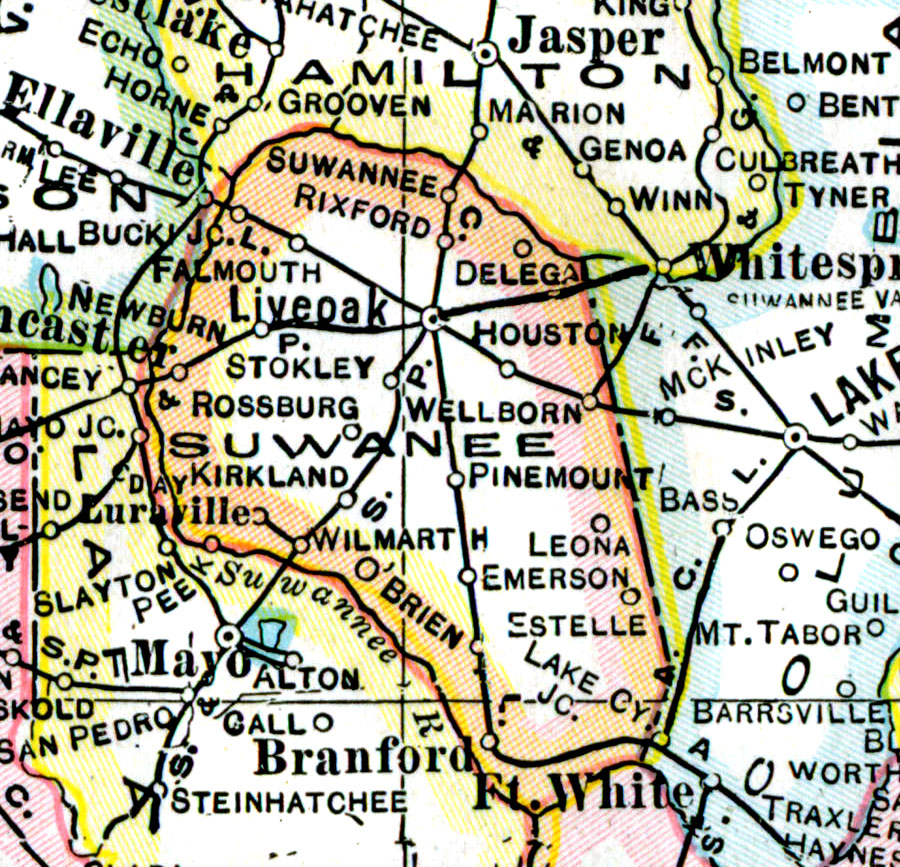
Description: A map of Suwannee County showing county lines, the county seat (Live Oak), and railroads connecting the major cities current to 1921.
Place Names: Suwannee, Suwannee, Rixford, Live Oak, Houston, O'Brien, Delega, Wellborne, Leona, Emerson, Wilmarth, Rossburg, Kirkland, Stokley
ISO Topic Categories: boundaries, inlandWaters, transportation
Keywords: Suwannee County, physical, political, transportation, physical features, county borders, railroads, boundaries, inlandWaters, transportation, Unknown,1921
Source: George F. Cram, (Chicago, IL: George F. Cram Company, 1921) 46
Map Credit: Courtesy the private collection of Roy Winkelman. |
|