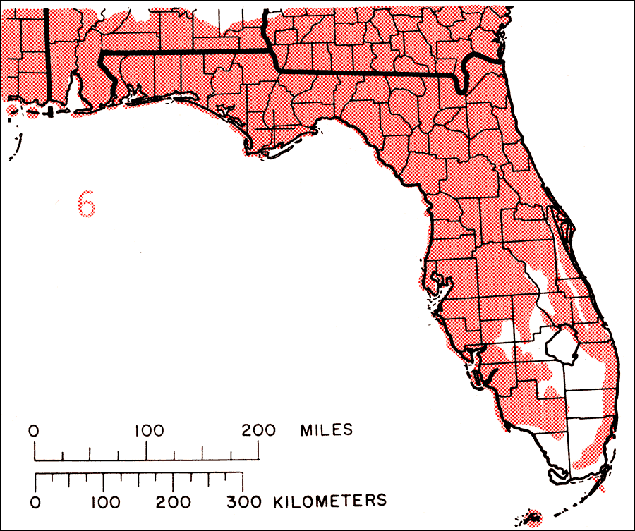
Description: This is a map showing the distribution of the Pinus elliottii or slash pine in Florida. "Coastal plain from s. S.C. to s. Florida and w. to se. Louisiana. The broken line on map 6 separates the 2 varieties: Var. elliottii, slash pine (typical). Coastal plain from s. S.C. to c. Florida and w. to se. Louisiana, Var. densa Little & Dorman, South Florida slash pine. S. Florida and n. along coasts to c. Florida. Also 8 of Lower Florida Keys (Big Pine, Little Pine, No Name, Middle Torch, Big Torch, Ramrod, Howe, Cudjoe) and extinct on Key Largo. Known only from Florida. For more information, read the introduction to the Atlas of United States Trees Vol. 5 Florida.
Place Names: Conifers, natural distribution of native tree species
ISO Topic Categories: biota, boundaries, environment
Keywords: Pinus elliottii or slash pine, physical, political, forestry, trees, county borders, biota, boundaries, environment, Unknown,1978
Source: Elbert L. Little, Jr., Atlas of United States Trees Volume 5 Florida (Washington, D.C.: United States Government Printing Office, 1978)
Map Credit: United States Government Printing Office |
|