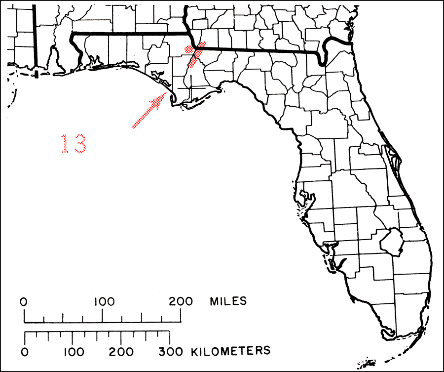
Description: This is a map showing the distribution of the Torreya taxifolia or Florida torreya in Florida. "Extreme sw. Georgia (Decatur Co.) and nw. Florida (Gadsden, Liberty and Jackson Cos.). Very rare and local and threatened by fungus disease." —Elbert L. Little, Jr. For more information, read the introduction to the Atlas of United States Trees Vol. 5 Florida.
Place Names: Conifers, natural distribution of native tree species
ISO Topic Categories: biota, boundaries, environment
Keywords: Torreya taxifolia or Florida torreya, physical, political, forestry, trees, county borders, biota, boundaries, environment, Unknown,1978
Source: Elbert L. Little, Jr., Atlas of United States Trees Volume 5 Florida (Washington, D.C.: United States Government Printing Office, 1978)
Map Credit: United States Government Printing Office |
|