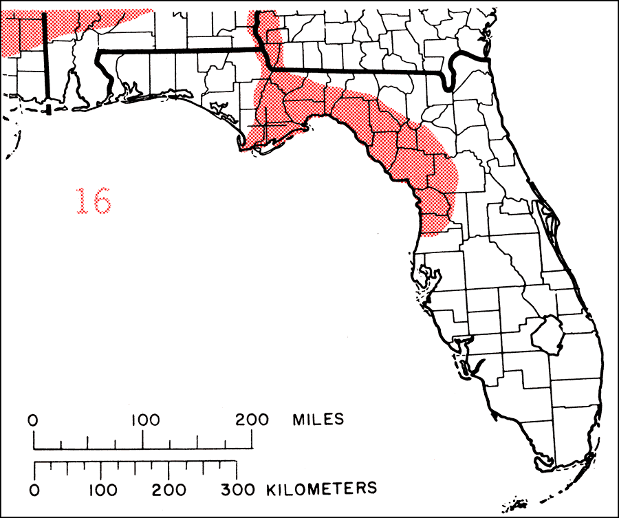
Description: This is a map showing the distribution of the Acer negundo or boxelder in Florida. "Very widespread through most of continental U.S. except New England and nw. N.J. and c. N.Y. w. to extreme s. Ontario, c. Michigan, n. Minnesota, c. Man., c. Sask., and s. Alta., s. to c. Missouri, e. Wyoming, Utah, and California, and e. to s. Texas and c. Florida. Also local in N.H., Vt., Mass., Conn., Idaho, and Nev. Naturalized ne. to Maine, s. Quebec, N.B., N.S., and P.E.I. and in se. Washington and e. Oregon. Also vars. in mts. of Mexico and Guatemala." —Elbert L. Little, Jr. For more information, read the introduction to the Atlas of United States Trees Vol. 5 Florida.
Place Names: Temperate Hardwoods A-B, natural distribution of native tree species
ISO Topic Categories: biota, boundaries, environment
Keywords: Acer negundo or boxelder, physical, political, forestry, trees, county borders, biota, boundaries, environment, Unknown,1978
Source: Elbert L. Little, Jr., Atlas of United States Trees Volume 5 Florida (Washington, D.C.: United States Government Printing Office, 1978)
Map Credit: United States Government Printing Office |
|