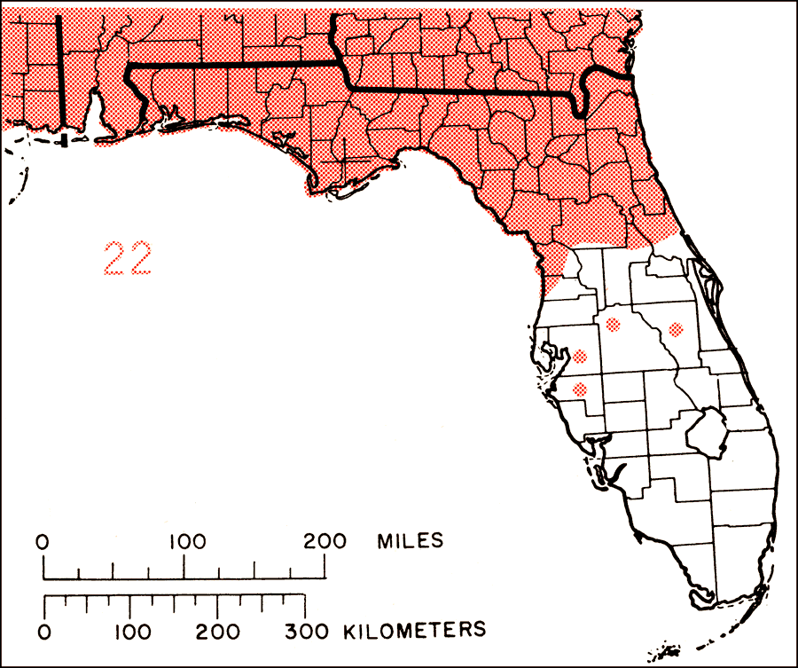
Description: This is a map showing the distribution of the Aralia spinosa or devils-walkingstick in Florida. "N.J. and c. and w. N.Y., to s. Ohio, s. Illinois, and se. Missouri, s. to se. Oklahoma and e. Texas, and e. to c. Florida. Also escaping from cult. from s. New England to Michigan and naturalized locally in Connecticut and perhaps elsewhere." —Elbert L. Little, Jr. For more information, read the introduction to the Atlas of United States Trees Vol. 5 Florida.
Place Names: Temperate Hardwoods A-B, natural distribution of native tree species
ISO Topic Categories: biota, boundaries, environment
Keywords: Aralia spinosa or devils-walkingstick, physical, political, forestry, trees, county borders, biota, boundaries, environment, Unknown,1978
Source: Elbert L. Little, Jr., Atlas of United States Trees Volume 5 Florida (Washington, D.C.: United States Government Printing Office, 1978)
Map Credit: United States Government Printing Office |
|