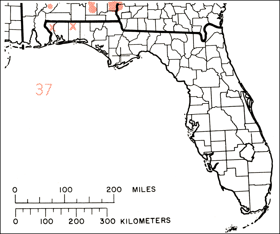
Description: This is a map showing the distribution of the Castanea dentata or American chestnut in Florida. "S. Maine w. to N.Y., extreme s. Ontario, se. Michigan, Ohio, s. Indiana, and extreme s. Illinois, s. to s. Mississippi and sw. Georgia. Formerly also nw. Florida. Almost exterminated nearly half century ago by the chestnut blight fungus, but stump sprouts persist." —Elbert L. Little, Jr. For more information, read the introduction to the Atlas of United States Trees Vol. 5 Florida.
Place Names: Temperate Hardwoods C-H, natural distribution of native tree species
ISO Topic Categories: biota, boundaries, environment
Keywords: Castanea dentata or American chestnut, physical, political, forestry, trees, county borders, biota, boundaries, environment, Unknown,1978
Source: Elbert L. Little, Jr., Atlas of United States Trees Volume 5 Florida (Washington, D.C.: United States Government Printing Office, 1978)
Map Credit: United States Government Printing Office |
|