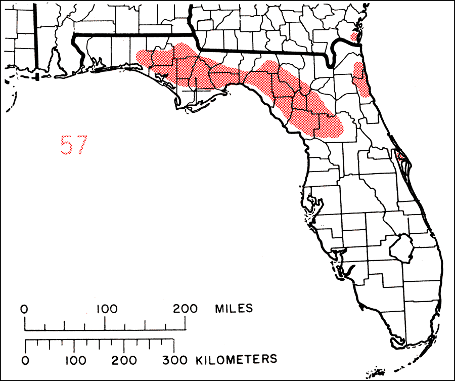
Description: This is a map showing the distribution of the Fraxinus profunda or pumpkin ash in Florida. "Local in swamps and river bottoms, chiefly in Coastal plain from s. Md. and se. Va. s. to n. Florida and w. to Louisiana, and n. in Mississippi Valley to se. Missouri, s. Illinois, Indiana and sw. Ohio." —Elbert L. Little, Jr. For more information, read the introduction to the Atlas of United States Trees Vol. 5 Florida.
Place Names: Temperate Hardwoods C-H, natural distribution of native tree species
ISO Topic Categories: biota, boundaries, environment
Keywords: Fraxinus profunda or pumpkin ash, physical, political, forestry, trees, county borders, biota, boundaries, environment, Unknown,1978
Source: Elbert L. Little, Jr., Atlas of United States Trees Volume 5 Florida (Washington, D.C.: United States Government Printing Office, 1978)
Map Credit: United States Government Printing Office |
|