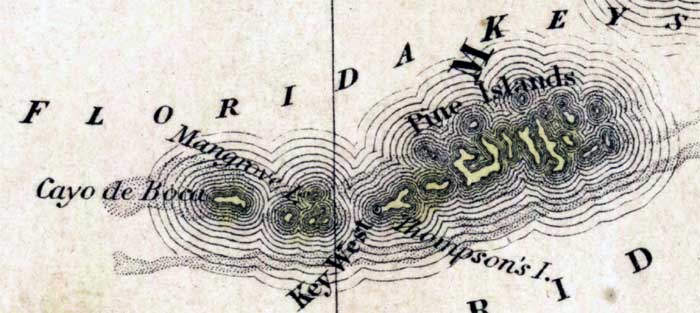
Description: This detail of a 1850 map from the New Universal Atlas shows the keys of Monroe County. The map is very similar to the 1839 map from Tanner's Universal Atlas. There are references to forts, battlefields, and routes used by the Army during the Seminole War. The keys labeled are Pine Islands, Mangrove Island, Cayo de Boca, and Thompson's Island.
Place Names: Monroe, Florida Keys, Pine Islands, Thompson's Island, Mangrove Island, Cayo de Boca,
ISO Topic Categories: boundaries, inlandWaters, oceans, society, transportation
Keywords: Monroe County - Keys, physical, political, transportation, historical, physical features, county borders, roads, other military, boundaries, inlandWaters, oceans, society, transportation, Unknown,1850
Source: Samuel Augustus Mitchell, A New Universal Atlas (Philadelphia, PA: Thomas, Cowperthwait & Co., 1850) 21
Map Credit: Courtesy the private collection of Roy Winkelman |
|