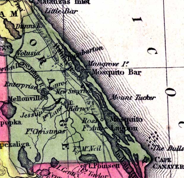
Description: This detail of a 1850 map from the New Universal Atlas shows towns, forts, roads, canals, major rivers and lakes in Orange County. The map is very similar to the 1839 map from Tanner's Universal Atlas. There are references to forts, battlefields, and routes used by the Army during the Seminole War. Some coastal features included in this detail are Mosquito Lagoon and Cape Canaveral.
Place Names: Orange, Little Bar, Dunns Island, Volusia, Dunbarton, Halifax River, New Smyrna, Mosquito Bar, Mount Tucker, Mosquito Lagoon, Saint Johns River, Lake Munroe, Enterprise, Mellonville, Jessup, Fort Christmas, Fort McNeil, Indian River, Cape Canaveral, Ross, Lake Harney,
ISO Topic Categories: boundaries, inlandWaters, oceans, society, transportation
Keywords: Orange County, physical, political, transportation, historical, physical features, county borders, roads, other military, boundaries, inlandWaters, oceans, society, transportation, Unknown,1850
Source: Samuel Augustus Mitchell, A New Universal Atlas (Philadelphia, PA: Thomas, Cowperthwait & Co., 1850) 21
Map Credit: Courtesy the private collection of Roy Winkelman |
|