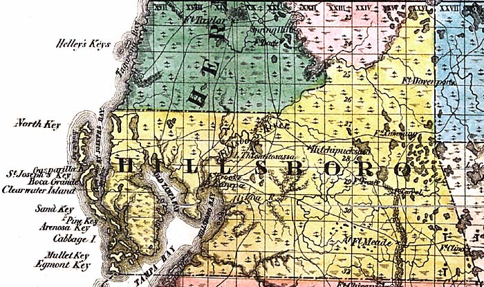
Description: This detail of a map from the annual report of the Surveyor General in 1856 shows Hillsborough County. Drainage, cities and towns, roads, trails, and location of railroad lines are shown in great detail. The major water features of the area are the Tampa Bay and the Hillsborough River. Other points of interest include various keys, Fort Meade, Fort Davenporte, and the Alifia River.
Place Names: Hillsborough, Hillsboro, Hillsborough, North Key, Gasparilla Key, Saint Joseph's Key, Boca Grande, Clearwater, Sand Key, Pine Key, Arenosa Key, Cabbage Island, Mullet Key, Egmont Key, Old Tampa Bay, Tampa, Tampa Bay, Hillboro Bay, Alifia, Fort Davenporte, Fort Meade, Fort Clinch,
ISO Topic Categories: boundaries, inlandWaters, oceans, society, transportation
Keywords: Hillsborough County, physical, political, transportation, physical features, major political subdivisions, county borders, local jurisdictions, roads, railroads, boundaries, inlandWaters, oceans, society, transportation, Unknown,1856
Source: Columbus Drew, (Jacksonville, FL: Columbus Drew, 1856)
Map Credit: Courtesy of the Geography and Map Division of the Library of Congress |
|