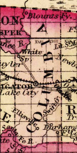
Description: This detail of a map of Florida was "Entered according to Act of Congress in the year 1863 by A. J. Johnson in the clerks office of the District Court of the United States for the Southern District of New York." It shows Columbia County in color, towns, villages, county seats, forts, railroads, and roads. The main features of the detail are Alligator and White Spring.
Place Names: Columbia, Blounts Ferry, White Spring, Alligator, Lake City, Ellisville, Swift Creek, Durham, Blount's Ferry
ISO Topic Categories: boundaries, inlandWaters, oceans, transportation
Keywords: Columbia County, physical, political, historical, transportation, physical features, county borders, railroads, roads, water routes, boundaries, inlandWaters, oceans, transportation, Unknown,1863
Source: Johnson, A.J., Johnson's New Illustrated Family Atlas (New York, NY: Johnson and Ward, 1863) 40
Map Credit: Courtesy the private collection of Roy Winkelman. |
|