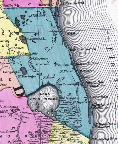
Description: This detail of a 1873 map of Florida, Georgia, and South Carolina shows county lines of the period, and Florida railroad routes between Fernandina and Cedar Keys, forts, and outlines major waterways for Brevard County. The major features of the detail are Lake Okeechobee, Fort McNeil, and the Saint Johns River.
Place Names: Brevard, Lake Okeechobee, Fort McNeil, Saint Johns, Saint Johns River, Kissimmee Lake, Fort Kissimee, Fort Drum, Kissimmee River, Istopaga Lake, Fort Basinger, Fort Lloyd, Fort Capron, Fort Pierce, Gilberts Bar, Saint Lucie Inlet, Orange Grove, Cypress Point, Fort Jupiter,
ISO Topic Categories: boundaries, inlandWaters, oceans, transportation
Keywords: Brevard County, physical, political, transportation, physical features, major political subdivisions, county borders, railroads, boundaries, inlandWaters, oceans, transportation, Unknown,1873
Source: Simon J. Martenet, New topographical atlas of the State of Ohio (, : Stedman, Brown & Lyon/H.H. Lloyd and Co., 1873) 89
Map Credit: Courtesy of the private collection of Roy Winkelman |
|