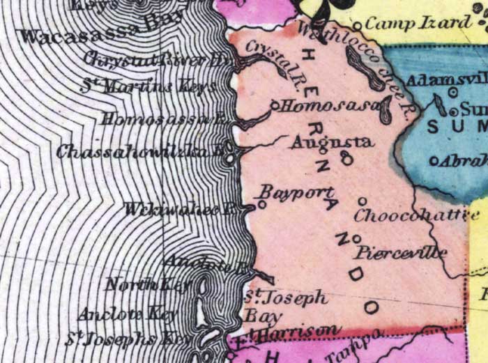
Description: This detail of a 1873 map of Florida, Georgia, and South Carolina shows an in color portrait of county lines of the period, Florida railroad routes, forts, and outlines major waterways for Hernando County. The major water features of the detail are the Crystal River, the Homosassa River, and the Withloccochee River. Other features include Bayport, Homosassa, and Pierceville.
Place Names: Hernando, Withloccochee River, Crystal River, Homosassa, Augusta, Bayport, Choocohattee, Pierceville, Saint Joseph Bay, Fort Harrison, Wacasassa Bay, Saint Martins Keys, Homosassa River, Chassahowitzka, Weckiwahee, Anclote, North Key, Aclote Key, Saint Josephs Key,
ISO Topic Categories: boundaries, inlandWaters, oceans, transportation
Keywords: Hernando County, physical, political, transportation, physical features, major political subdivisions, county borders, railroads, boundaries, inlandWaters, oceans, transportation, Unknown,1873
Source: Simon J. Martenet, New topographical atlas of the State of Ohio (, : Stedman, Brown & Lyon/H.H. Lloyd and Co., 1873) 89
Map Credit: Courtesy of the private collection of Roy Winkelman |
|