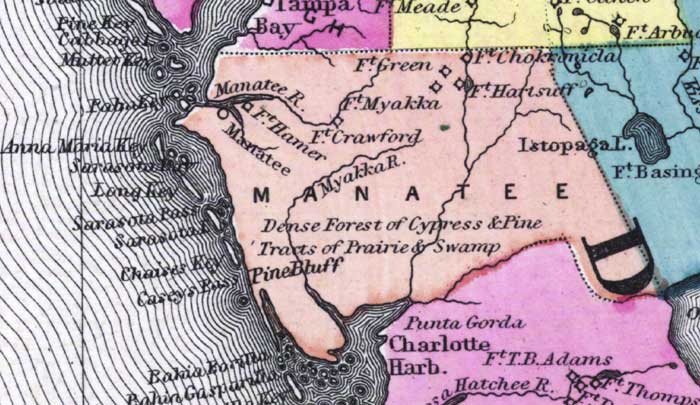
Description: This detail of a 1873 map of Florida, Georgia, and South Carolina shows an in color portrait of county lines of the period, Florida railroad routes, forts, and outlines major waterways for Manatee County. The major water features of the detail are the Manatee River and the Myakka River. Other features include Pine Bluff, Fort Green, and Casey's Pass,
Place Names: Manatee, Fort Chokkonicla, Fort Hartsuff, Istopaga Lake, Fort Green, Fort Myakka, Fort Crawford, Myakka River, Manatee River, Fort Hamer, Manatee, Pine Bluff, Pine Key, Cabbage Key, Mullet Key, Anna Maria KEy, Sarasota Bay, Long Key, Sarasota Pass, Sarasota Island, Chaises Key, Casey's Pass, Bahia Borilla, Charlotte Harbor, Punta Gorda
ISO Topic Categories: boundaries, inlandWaters, oceans, transportation
Keywords: Manatee County, physical, political, transportation, physical features, major political subdivisions, county borders, railroads, boundaries, inlandWaters, oceans, transportation, Unknown,1873
Source: Simon J. Martenet, New topographical atlas of the State of Ohio (, : Stedman, Brown & Lyon/H.H. Lloyd and Co., 1873) 89
Map Credit: Courtesy of the private collection of Roy Winkelman |
|