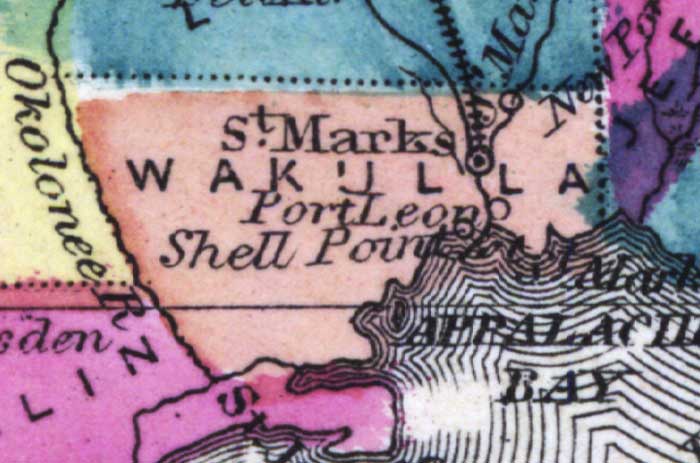
Description: This detail of a 1873 map of Florida, Georgia, and South Carolina shows an in color portrait of county lines of the period, Florida railroad routes, forts, and outlines major waterways for Wakulla County. The major water features of the detail are the Ocklockonee River and Appalachie Bay. Other features include Saint Marks and Port Leon.
Place Names: Wakulla, Saint Marks, Port Leon, Shell Point, Appalachie Bay, Ocklockonee, St Marks, St. Marks
ISO Topic Categories: boundaries, inlandWaters, oceans, transportation
Keywords: Wakulla County, physical, political, transportation, physical features, major political subdivisions, county borders, railroads, boundaries, inlandWaters, oceans, transportation, Unknown,1873
Source: Simon J. Martenet, New topographical atlas of the State of Ohio (, : Stedman, Brown & Lyon/H.H. Lloyd and Co., 1873) 89
Map Credit: Courtesy of the private collection of Roy Winkelman |
|