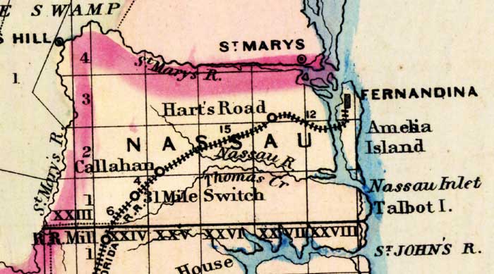
Description: This 1871 detail of Florida shows county lines and county seats current to the period, major towns and cities, and railroad routes and stations for Nassau County. The major water features of this detail are the Saint Marys River and the Saint Johns River. Other locations include Fernandina and Callahan. Digitization provided by the USF Libraries Digitization Center.
Place Names: Nassau, Hart's Road, Saint Marys River, Fernandina, Amila Island, Nassau Inlet, Talbot Island, Saint Johns, 31 Mile Switch, Callahan, Thomas Creek,
ISO Topic Categories: boundaries, inlandWaters, oceans, transportation
Keywords: Nassau County, physical, political, transportation, physical features, major political subdivisions, county borders, railroads, boundaries, inlandWaters, oceans, transportation, Unknown,1871
Source: Asher & Adams, Asher & Adams' new commercial, topographical, and statistical atlas and gazetteer of the United States (New York, NY: Asher & Adams, 1871)
Map Credit: Courtesy of the private collection of Roy Winkelman |
|