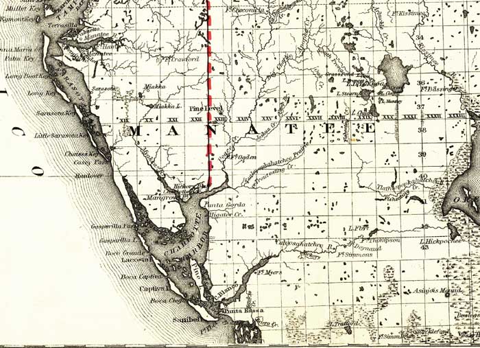
Description: This detail of a map of Florida covers Manatee County and vicinity and indicates drainage, cities and towns, township and county boundaries, railroads, and the 15-mile railroad land grant limits surrounding the track. The major water features of the detail include Charlotte Harbor and Lake Okeechobee. Some of the townships listed are Punta Gorda and Sarasota.
Place Names: Manatee, Charlotte Harbor, Lake Okeechobee, Pine Level, Fort Ogden, Peace Creek, Punta Gorda, Alligator Creek, Gasparilla, Handover, Lake Flirt, Sarasota, Lake Istokpoga, Fort Bassinger,
ISO Topic Categories: boundaries, inlandWaters, oceans, transportation
Keywords: Manatee County, physical, political, transportation, physical features, major political subdivisions, county borders, railroads, boundaries, inlandWaters, oceans, transportation, Unknown,1882
Source: G.W. & C.B. Colton, (New York, NY: G.W. & C.B. Colton & Co. , 1882)
Map Credit: Courtesy of the Geography and Map Division of the Library of Congress |
|