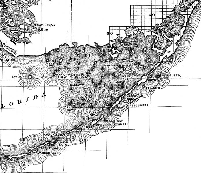
Description: This detail shows county lines and county seats current to the period, major towns and cities, and railroad routes and stations for the Upper Keys of Monroe County. The Townships are subdivided into sections, and those sections offered for sale by the land department of the South Florida R.R. Company are shown in orange. Map scale is 1:633,600. Notable features of the detail include Barnes Sound, Tavanier Key, and Conch Keys.
Place Names: Monroe, Cards Sound, Buck Key, Largo, Barnes Sound, Shell Key, Captain's Key, Mud Key, Charles Key, Jones Key, Rabbit Key, Lignum Vitae, Matacombe, Long Island, Dove Key, Indian Key, Conch Keys, Fat Deer Key, Key Vaccas,
ISO Topic Categories: boundaries, inlandWaters, oceans, transportation
Keywords: Monroe County - Upper Keys, physical, political, transportation, physical features, major political subdivisions, county borders, local jurisdictions, railroads, boundaries, inlandWaters, oceans, transportation, Unknown,1888
Source: D. H. Elliott, (Sanford, FL: South Florida R. R. Co. and the Plant Investment Co, 1888)
Map Credit: Courtesy the private collection of Roy Winkelman |
|