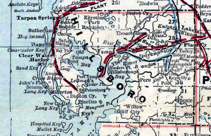
Description: This is a detail of a map of Florida showing counties, railroads, cities, inland waters, etc for Hillsborough County. Each color represents a different route. The origin and destination for each route is found on the main map in an Explanation key. Features of this detail include Tampa Bay, the Hillsborough River, and Saint Petersburg.
Place Names: Hillsborough, Tarpon Springs, Dunedin, Clearwater, Seminole, New Cadiz, Pinellas, Saint Petersburg, De Soto, Ozona, Keystone Park, Magdalene, Thonotosassa, Diston, Tampa, Ybor City, Hillsborough Bay, Tampa Bay, Hillsborough River, Seffner, Lakeland, Plant City, Valrico, Peru, Brandon, Picnic, Gulf City,
ISO Topic Categories: inlandWaters, oceans, boundaries, transportation
Keywords: Hillsborough County, physical, historical, political, transportation, physical features, county borders, railroads, inlandWaters, oceans, boundaries, transportation, Unknown,1889
Source: Wm. M. Bradley and Bros., Bradley's atlas of the world for commercial and library reference (Philadelphia, PA: Wm. M. Bradley and Bros., 1889) 240-241
Map Credit: Courtesy of the Special Collections Department, University of South Florida. |
|