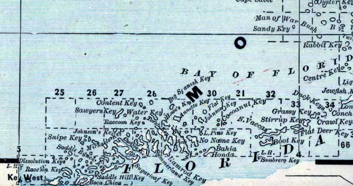
Description: This is a detail of a map of Florida showing counties, railroads, cities, inland waters, etc for the lower keys of Monroe County. Each color represents a different route. The origin and destination for each route is found on the main map in an Explanation key. Features of this detail include Key West, Sugarloaf Key, and Sombrero Key.
Place Names: Monroe, Key West, Jewfish, Cocoanut Key, Content Key, Sawyer's Key, Snipe Key, Racoon Key, Boca Chica, Sugarloaf Key, Sombrero Key, Ramrod Key, Bahia Honda,
ISO Topic Categories: inlandWaters, oceans, boundaries, transportation
Keywords: Monroe County - Lower Keys, physical, historical, political, transportation, physical features, county borders, railroads, inlandWaters, oceans, boundaries, transportation, Unknown,1889
Source: Wm. M. Bradley and Bros., Bradley's atlas of the world for commercial and library reference (Philadelphia, PA: Wm. M. Bradley and Bros., 1889) 240-241
Map Credit: Courtesy of the Special Collections Department, University of South Florida. |
|