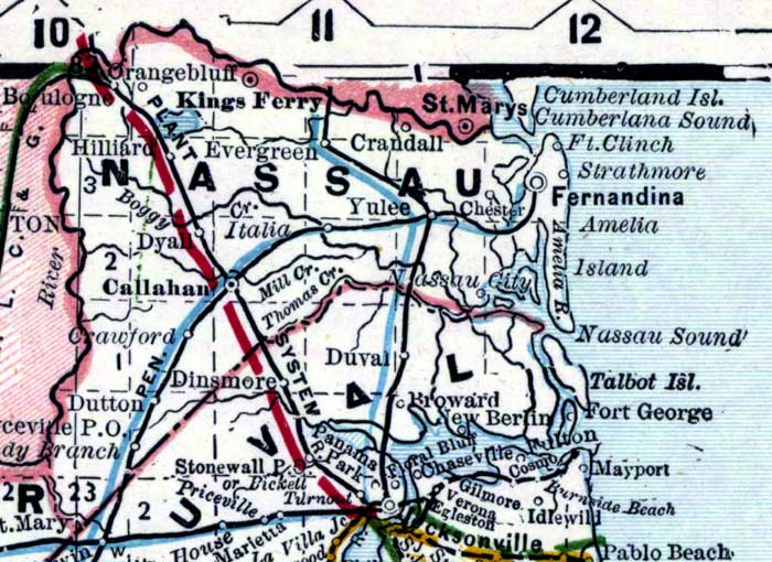
Description: This is a detail of a map of Florida showing counties, railroads, cities, inland waters, etc for Nassau County. Each color represents a different route. The origin and destination for each route is found on the main map in an Explanation key. Features of this detail include the Saint Johns River, Fernandina, and Callahan.
Place Names: Nassau, Orangebluff, Kings Ferry, Crandall, Saint Marys, Evergreen, Yulee, Fernandina, Fort Clinch, Amelia Island, Nassau Sound, Talbot Island, Fort George, Mayport, Saint Johns River, Duval, Broward, New Berlin, Stonewall, Dinsmore, Dutton, Crawford, Callahan, Dyall, Dyal, Italia, Hilliard, Boulogne, Chester
ISO Topic Categories: inlandWaters, oceans, boundaries, transportation
Keywords: Nassau County, physical, historical, political, transportation, physical features, county borders, railroads, inlandWaters, oceans, boundaries, transportation, Unknown,1889
Source: Wm. M. Bradley and Bros., Bradley's atlas of the world for commercial and library reference (Philadelphia, PA: Wm. M. Bradley and Bros., 1889) 240-241
Map Credit: Courtesy of the Special Collections Department, University of South Florida. |
|