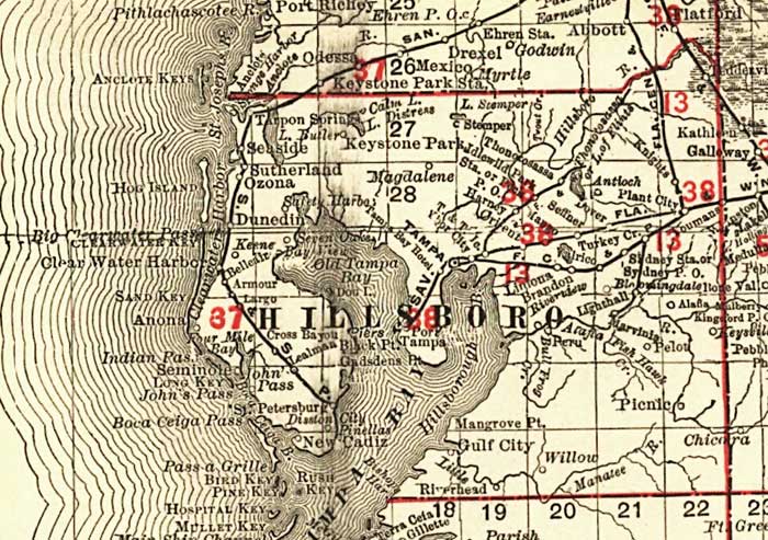
Description: This detail of Hillsborough County shows railroads, county boundaries, wetlands, cities, towns, villages, post offices, lakes, and rivers current to 1900. There are 33 railroad lines listed on the main map, as a guide to the numbering. The map was a pocket guide to Florida's railroads. Features in this detail include Tarpon Springs, Tampa, and Seffner.
Place Names: Hillsborough, Hillsborough Bay, Tarpon Springs, Keystone Park, Tampa, Tampa Bay, Gulf City, Picnic, Peru, Lighthall, Seffner, Orient, Dover, Antioch, Thonotosassa, Magdalene, Ozona, Sutherland, Dunedin, Keene, Armour, Largo, Anona, Sand Key, Clearwater, Hog Island, Pinellas, Saint Petersburg,
ISO Topic Categories: boundaries, transportation, inlandWaters, oceans
Keywords: Florida Railroads - Hillsborough County, physical, political, transportation, swamps, everglades, wetlands, physical features, county borders, railroads, boundaries, transportation, inlandWaters, oceans, Unknown,1900
Source: Rand, McNally & Co., (, : , 1900)
Map Credit: Courtesy the private collection of Roy Winkelman. |
|