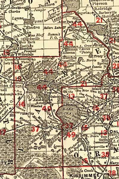
Description: This detail of Lake County shows railroads, county boundaries, wetlands, cities, towns, villages, post offices, lakes, and rivers current to 1900. There are 33 railroad lines listed on the main map, as a guide to the numbering. The map was a pocket guide to Florida's railroads. Features in this detail include Astor, Clermont, and Minneola.
Place Names: Lake, Tavares, Astor, Astor Park, Summit Station, Aeron, Paisley, Lake Apopka, Cassia, Winsted, Minneola, Sheridan, Clermont, Esmeralda,
ISO Topic Categories: boundaries, transportation, inlandWaters, oceans
Keywords: Florida Railroads - Lake County, physical, political, transportation, swamps, everglades, wetlands, physical features, county borders, railroads, boundaries, transportation, inlandWaters, oceans, Unknown,1900
Source: Rand, McNally & Co., (, : , 1900)
Map Credit: Courtesy the private collection of Roy Winkelman. |
|