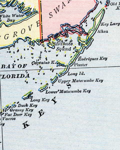
Description: This is a detail of a map of Florida, displaying county borders, county seats, and railroads current to 1902 for the upper keys of Monroe County. Major and minor cities are shown, as well as major waterways. The features of the map include the Bay of Florida, Key Largo, and Planter.
Place Names: Monroe, Bay of Florida, Key Largo, Aikea, Rodriguez Key, Planter, Long Island, Upper Matecumbe Key, Lower Matecumbe Key, Long Key, Duck Key, Grassy Key, Fat Deer Key, Captains Key,
ISO Topic Categories: boundaries, oceans, inlandWaters, transportation
Keywords: Monroe County - Upper Keys, physical, political, transportation, physical features, county borders, railroads, boundaries, oceans, inlandWaters, transportation, Unknown,1902
Source: George Franklin Cram, Cram's Atlas (Chicago, Il: George F. Cram, 1902)
Map Credit: Courtesy the private collection of Roy Winkelman. |
|