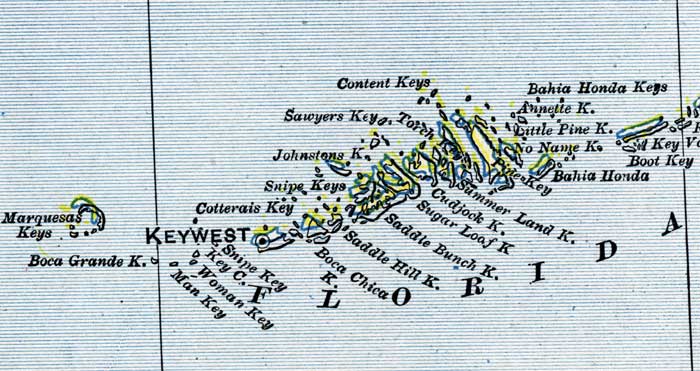
Description: This is a detail of a map of Florida, displaying county borders, county seats, and railroads current to 1902 for the lower keys of Monroe County. Major and minor cities are shown, as well as major waterways. The features of the map include Key West, Annette Key, and Bahia Honda.
Place Names: Monroe, Marquesas Keys, Boca Grande, Key West, Man Key, Woman Key, Snipe Key, Cotterais Key, Boca Chica Key, Saddle Hill, Saddle Bunch, Sugar Loaf, Cudjock, Summer Land, Pines Key, Bahia Honda, Name, Little Pine, Annette, Boot Key, Content Keys, Sawyers Key, Torch Key, Johnstons Key, Sugarloaf Key
ISO Topic Categories: boundaries, oceans, inlandWaters, transportation
Keywords: Monroe County - Lower Keys, physical, political, transportation, physical features, county borders, railroads, boundaries, oceans, inlandWaters, transportation, Unknown,1902
Source: George Franklin Cram, Cram's Atlas (Chicago, Il: George F. Cram, 1902)
Map Credit: Courtesy the private collection of Roy Winkelman. |
|