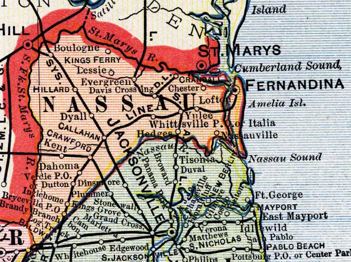
Description: This is a detail of a map of Florida, displaying county borders, county seats, and railroads current to 1902 for Nassau County. Major and minor cities are shown, as well as major waterways. The features of the map include Fernandina, Saint Marys, and the Nassau River.
Place Names: Nassau, Saint Marys, Saint Marys River, Cumberland Sound, Fernandina, Amelia Island, Itlaia, Nassauville, Nassau River, Whittsville, Yulee, Hedges, Chester, Drandall, Boulogne, Kings Ferry, Lessie, Evergreen, Davis Crossing, Hillard, Dyall, Callahan, Crawford, Kent, Dahoma, Verdie, Dutton, Inglehome, Bryceville, Hilliard, Italia
ISO Topic Categories: boundaries, oceans, inlandWaters, transportation
Keywords: Nassau County, physical, political, transportation, physical features, county borders, railroads, boundaries, oceans, inlandWaters, transportation, Unknown,1902
Source: George Franklin Cram, Cram's Atlas (Chicago, Il: George F. Cram, 1902)
Map Credit: Courtesy the private collection of Roy Winkelman. |
|