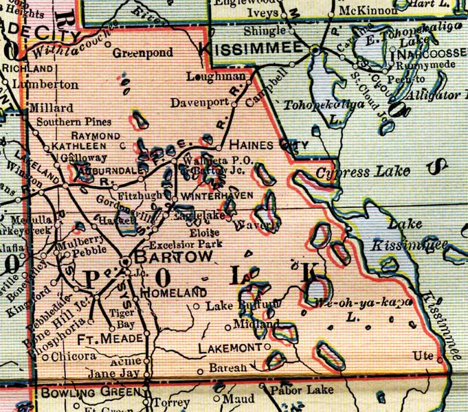
Description: This is a detail of a map of Florida, displaying county borders, county seats, and railroads current to 1902 for Polk County. Major and minor cities are shown, as well as major waterways. The features of the map include Bartow, Fort Meade, and Mulberry.
Place Names: Polk, Greenpond, Withlacoochee River, Loughman, Davenport, Haines City, Winterhaven, Winter Haven, Ute, Lakemonto, Bareah, Midland, Lake Bufford, Homeland, Tiger Bay, Fort Meade, Acme, Jane Jay, Phosphoria, Bone Hill, Pebbledale, Kingsford, Bonevalley, Mulberry, Pebble, Medulla, Fitzhugh, Auburndale, Galloway, Kathleen, Raymond, Southern Pines, Millard,
ISO Topic Categories: boundaries, oceans, inlandWaters, transportation
Keywords: Polk County, physical, political, transportation, physical features, county borders, railroads, boundaries, oceans, inlandWaters, transportation, Unknown,1902
Source: George Franklin Cram, Cram's Atlas (Chicago, Il: George F. Cram, 1902)
Map Credit: Courtesy the private collection of Roy Winkelman. |
|