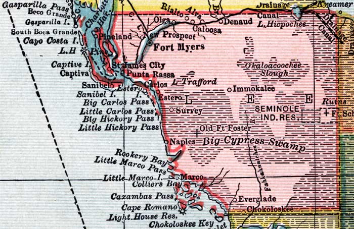
Description: This detail of a map of Florida shows county boundaries, roads, cities, towns, villages, lakes, and rivers current to 1910 for Lee County. On the main map, counties and major cities and towns are listed along the left and bottoms edges with corresponding coordinates. The counties are also colored for ease of differentiation. The main features of this detail include Fort Myers, Alva, and Punta Rassa.
Place Names: Lee, Fort Myers, Rialto, Alva, Denaud, Okaloacoochee Slough, Immokalee, Big Cypress Swamp, Naples, Survey, Estero, Lake Tefford, Carlos, Punta Rassa, Saint James City, Pineland, Charlotte Harbor, Marco, Colliers Bay, Cape Romano, Captiva, Cayo Costa, South Boca Grande, Gasparilla Island,
ISO Topic Categories: boundaries, transportation, inlandWaters, oceans
Keywords: Lee County, physical, political, transportation, swamps, everglades, wetlands, physical features, county borders, roads, boundaries, transportation, inlandWaters, oceans, Unknown,1910
Source: , Atlas of the World (New York, NY: C.S. Hammond & Company, 1910) 84
Map Credit: Courtesy the private collection of Roy Winkelman. |
|