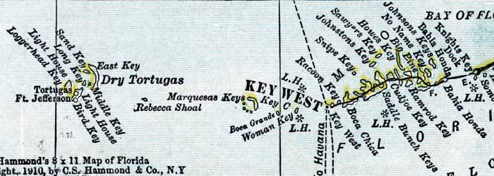
Description: This detail of a map of Florida shows county boundaries, roads, cities, towns, villages, lakes, and rivers current to 1910 for the lower keys of Monroe County. On the main map, counties and major cities and towns are listed along the left and bottoms edges with corresponding coordinates. The counties are also colored for ease of differentiation. The main features of this detail include Key West, Dry Tortugas, and Big Pine Key.
Place Names: Monroe, Knights Key, Bahia Honda, Johnsons Keys, No Name Key, Big Pine, Howes Key, Ramrod Key, Cudjoe, Saddle Bunch Key, Sawyers Key, Johnstons Key, Snipe Key, Racoon Key, Boca Chica, Key West, Marquesas Keys, Dry Tortugas,
ISO Topic Categories: boundaries, transportation, inlandWaters, oceans
Keywords: Monroe County - Lower Keys, physical, political, transportation, swamps, everglades, wetlands, physical features, county borders, roads, boundaries, transportation, inlandWaters, oceans, Unknown,1910
Source: , Atlas of the World (New York, NY: C.S. Hammond & Company, 1910) 84
Map Credit: Courtesy the private collection of Roy Winkelman. |
|