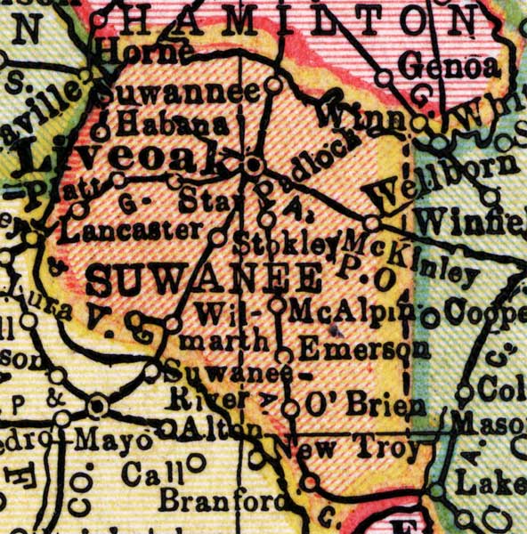
Description: This detail of a map of Florida shows county boundaries, roads, cities, towns, villages, lakes, and rivers current to 1910 for Suwannee County. On the main map, counties and major cities and towns are listed along the left and bottoms edges with corresponding coordinates. The counties are also colored for ease of differentiation. The main features of this detail include Live Oak, McAlpin, and O'Brien.
Place Names: Suwannee, Suwannee, Habana, Padlock, Star, Live Oak, Lancaster, McAlpin, Emerson, O'Brien, New Troy, Stokley,
ISO Topic Categories: boundaries, transportation, inlandWaters, oceans
Keywords: Suwannee County, physical, political, transportation, swamps, everglades, wetlands, physical features, county borders, roads, boundaries, transportation, inlandWaters, oceans, Unknown,1910
Source: , Atlas of the World (New York, NY: C.S. Hammond & Company, 1910) 84
Map Credit: Courtesy the private collection of Roy Winkelman. |
|