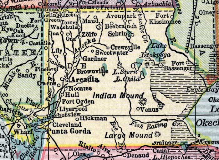
Description: This detail of a map of Florida shows county boundaries, roads, cities, towns, villages, lakes, and rivers current to 1916 for DeSoto County. This detail has counties and major cities and towns listed in larger font. The counties are also colored for ease of differentiation. Features of this detail include Arcadia, Sebring, and Hull.
Place Names: Desoto, Avonpark, Fort Kissimmee, Beebranch, Sebring, Crewsville, Sweetwater, Lake Istokpoga, Fort Bassenger, Venus, Punta Gorda, Cleveland, Liverpool, Fort OGden, Hull, Nocatee, Arcadia, Brownville, Gardner, Zolfo, Maud, Ona, Lily, Bunker, Pine Level, Torrey, Wauchula, Bowling Green, Fort Kissimmee,
ISO Topic Categories: boundaries, transportation, inlandWaters, oceans
Keywords: DeSoto County, physical, political, transportation, swamps, everglades, wetlands, physical features, county borders, roads, boundaries, transportation, inlandWaters, oceans, Unknown,1916
Source: , New Reference Atlas of the World (New York, NY: C.S. Hammond & Company, 1916) 84
Map Credit: Courtesy the private collection of Roy Winkelman. |
|