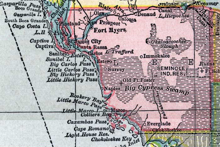
Description: This detail of a map of Florida shows county boundaries, roads, cities, towns, villages, lakes, and rivers current to 1916 for Lee County. This detail has counties and major cities and towns listed in larger font. The counties are also colored for ease of differentiation. Features of this detail include Alva, Fort Myers, and Naples.
Place Names: Lee, Fort Myers, Caloosa, Rialto, Alva, Denaud, Okaloacoochee Slough, Immokalee, Old Fort Foster, Survey, Estero, Carlos, Punta Rassa, Saint James City, Pineland, Captiva, Marco, Naples,
ISO Topic Categories: boundaries, transportation, inlandWaters, oceans
Keywords: Lee County, physical, political, transportation, swamps, everglades, wetlands, physical features, county borders, roads, boundaries, transportation, inlandWaters, oceans, Unknown,1916
Source: , New Reference Atlas of the World (New York, NY: C.S. Hammond & Company, 1916) 84
Map Credit: Courtesy the private collection of Roy Winkelman. |
|