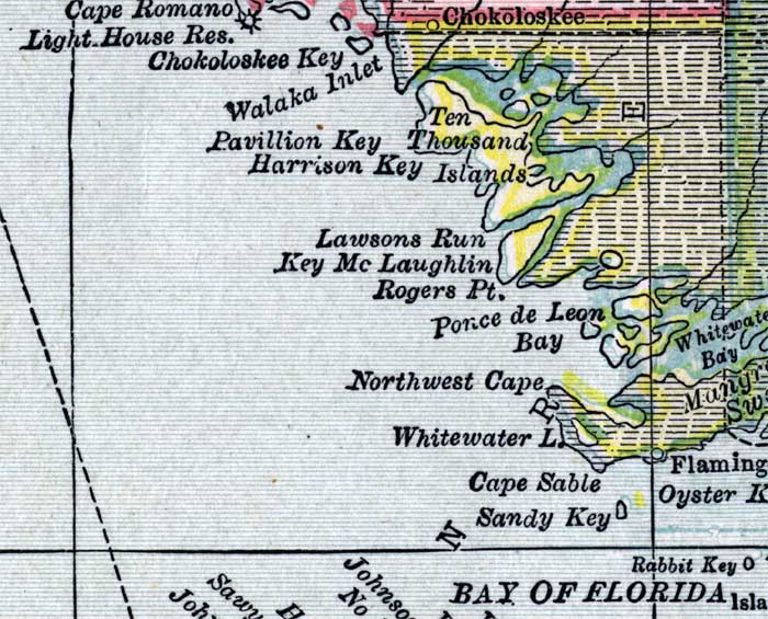
Description: This detail of a map of Florida shows county boundaries, roads, cities, towns, villages, lakes, and rivers current to 1916 for the mainland of Monroe County. This detail has counties and major cities and towns listed in larger font. The counties are also colored for ease of differentiation. Features of this detail include Ten Thousand Islands, Cape Sable, and Flamingo.
Place Names: Monroe, Ten Thousand Islands, Pvillion Key, Harrison Key, Lawsons Run, Key McLaughlin, Rogers Point, Ponce De Leon Bay, Northwest Cape, Whitewater Lake, Whatewater Bay, Cape Sable, Sandy Key, Flamingo
ISO Topic Categories: boundaries, transportation, inlandWaters, oceans
Keywords: Monroe County - Mainland, physical, political, transportation, swamps, everglades, wetlands, physical features, county borders, roads, boundaries, transportation, inlandWaters, oceans, Unknown,1916
Source: , New Reference Atlas of the World (New York, NY: C.S. Hammond & Company, 1916) 84
Map Credit: Courtesy the private collection of Roy Winkelman. |
|