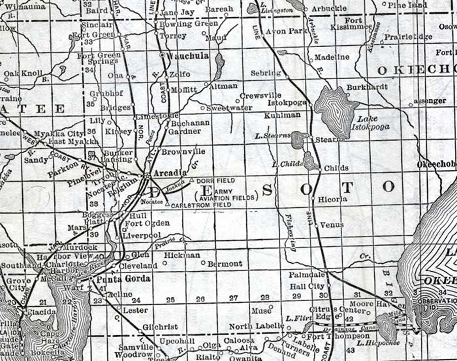
Description: This detail of a map of Florida shows railroads and major cities and towns current to 1920 for DeSoto County. Major waterways are present, though secondary to the railways functions. Featured cities in this detail include Platt, Belgium, and Hull.
Place Names: Desoto, Sinclair, Fort Green, Fort Green Springs, Ona, Grubhof, Bridges, Lily, Kinsey, Bunker, Lansing, Pine Level, Tryon, Nocatee, Belgium, Boggess, Platt, Mars, Hull, Fort Ogden, Liverpool, Glen, Cleveland, Punta Gorda, Aclino, Lester, Gilchrist, Bermont, Hickman, Venus, Hicoria, Childs, Stearns, Lake Okeechobee, Lake Istokpoga, Burkhardt, Madeline, Avon Park, Sepring, Crewsville, Altman, Sweetwater, Wauchaula, Torrey, Bowling Green, Maud, Moffitt, Zolfo, Buchanan, Limestone,
ISO Topic Categories: boundaries, transportation, inlandWaters, oceans
Keywords: DeSoto County, physical, political, transportation, swamps, everglades, wetlands, physical features, county borders, railroads, boundaries, transportation, inlandWaters, oceans, Unknown,1920
Source: , (, : US Railroad Administration, 1920)
Map Credit: Courtesy the private collection of Roy Winkelman. |
|