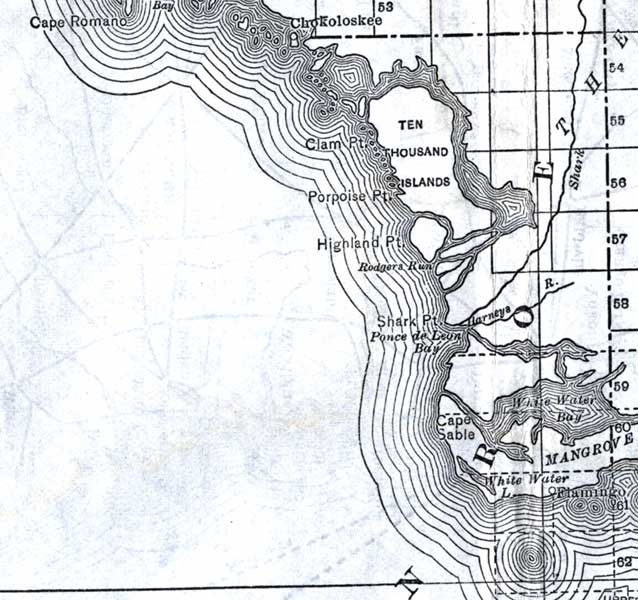
Description: This detail of a map of Florida shows railroads and major cities and towns current to 1920 for the mainland of Monroe County. Major waterways are present, though secondary to the railways functions. Features in this detail include Ten Thousand Islands, Cape Sable, and the Flamingo.
Place Names: Monroe, Ten Thousand Islands, White Water Bay, Clam Point, Porpoise Point, Highland Point, Rodgers Run, Shark Point, Ponce De Leon Bay, Cape Sable, Flamingo
ISO Topic Categories: boundaries, transportation, inlandWaters, oceans
Keywords: Monroe County - Mainland, physical, political, transportation, swamps, everglades, wetlands, physical features, county borders, railroads, boundaries, transportation, inlandWaters, oceans, Unknown,1920
Source: , (, : US Railroad Administration, 1920)
Map Credit: Courtesy the private collection of Roy Winkelman. |
|