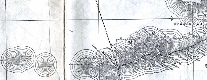
Description: This detail of a map of Florida shows railroads and major cities and towns current to 1920 for Monroe County. Major waterways are present, though secondary to the railways functions. Features in this detail include Key West, the Dry Tortugas, and Marquesas Key.
Place Names: Monroe, Flroida Bay, Key West, Dry Tortugas, Marquesas Key, Bahia Honda, Spanish Harbor,
ISO Topic Categories: boundaries, transportation, inlandWaters, oceans
Keywords: Monroe County - The Keys, physical, political, transportation, swamps, everglades, wetlands, physical features, county borders, railroads, boundaries, transportation, inlandWaters, oceans, Unknown,1920
Source: , (, : US Railroad Administration, 1920)
Map Credit: Courtesy the private collection of Roy Winkelman. |
|