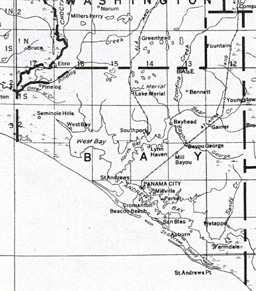
Description: This detail of a map of Florida shows railroads and major cities and towns current to 1932 for Bay County. Major waterways are shown, as well as lakes, town, islands, and marsh. Other notable features are Seminole Indian Reservations, canals, and railroads. Features included in this detail are Lynn Haven, Panama City, and Wetappo.
Place Names: Bay, Pinelog, Seminole Hills, West Bay, Southport, Lake Merial, Bennett, Bayhead, Youngstown, Gainer, Bayou George, Mill Bayou, Panama City, Millville, Parker, Wetappo, Farmdale, Auburn, San Blas,Cromanton, Beacon Beach, Saint Andrews, Lynn Haven,
ISO Topic Categories: boundaries, transportation, inlandWaters, oceans
Keywords: Bay County, physical, political, transportation, swamps, everglades, wetlands, physical features, county borders, railroads, boundaries, transportation, inlandWaters, oceans, Unknown,1932
Source: , (, : US Department of the Interior Geological Survey, 1932)
Map Credit: Courtesy the private collection of Roy Winkelman. |
|