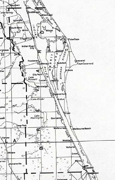
Description: This detail of a map of Florida shows railroads and major cities and towns current to 1932 for Brevard County. Major waterways are shown, as well as lakes, town, islands, and marsh. Other notable features are Seminole Indian Reservations, canals, and railroads. Features included in this detail are Cape Canaveral, Malabar, and Micco.
Place Names: Brevard, Shiloh, Allenhurst, Aurantia, South Mere, Wilson, Mims, Titusville, Indian River City, Orsine, Frontenac, Courtenay, City Point, Audubon, Cape Canaveral, Artesia, Merritt, Cocoa, Rockledge, Bonaventure, Lotus, Tropic, Eau Gallie, Melbounrne, Melbourne Beach, Malabar, Valkaria, Grant, Micco,
ISO Topic Categories: boundaries, transportation, inlandWaters, oceans
Keywords: Brevard County, physical, political, transportation, swamps, everglades, wetlands, physical features, county borders, railroads, boundaries, transportation, inlandWaters, oceans, Unknown,1932
Source: , (, : US Department of the Interior Geological Survey, 1932)
Map Credit: Courtesy the private collection of Roy Winkelman. |
|