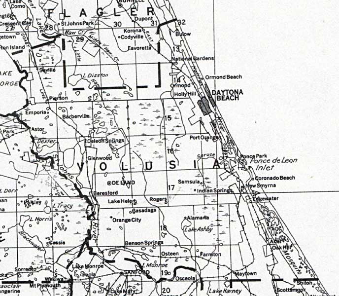
Description: This detail of a map of Florida shows railroads and major cities and towns current to 1932 for Volusia County. Major waterways are shown, as well as lakes, town, islands, and marsh. Other notable features are Seminole Indian Reservations, canals, and railroads. Features included in this detail are Daytona Beach, DeLand, and Pierson.
Place Names: Volusia, Bulow, National Gardens, Ormond, Ormond Beach, Daytona Beach, Holly Hill, Port Orange, Ponce Park, Coronado Beach, DeLand, Barberville, Parson, Glenwood, Astor, Seville,
ISO Topic Categories: boundaries, transportation, inlandWaters, oceans
Keywords: Volusia County, physical, political, transportation, swamps, everglades, wetlands, physical features, county borders, railroads, boundaries, transportation, inlandWaters, oceans, Unknown,1932
Source: , (, : US Department of the Interior Geological Survey, 1932)
Map Credit: Courtesy the private collection of Roy Winkelman. |
|