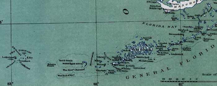
Description: This detail of a map of Florida shows topographical information for the keys of Monroe County in 1865. Railroads, roads, and towns are also shown. Some of these features include the Dry Tortugas and Key West.
Place Names: Monroe, Dry Tortugas, Bahia Honda, Key West, Saddle Bluff, Quick Sands,
ISO Topic Categories: inlandWaters, location, transportation, oceans
Keywords: Monroe County - Keys, transportation, physical, political, topographical, country borders, roads, railroads, inlandWaters, location, transportation, oceans, 1865
Source: Julius Bien and Co., General Topographical Map Sheet XI, Atlas to Accompany the Official Records of the Union and Confederate Armies (New York, NY: US Government Printing Office, 1865)
Map Credit: Courtesy of the private collection of Roy Winkelman |
|