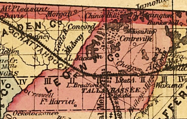
Description: This detail of a map of Florida indicates Leon County current to 1874. It shows drainage, township and county boundaries, cities and towns, battlefields, and submarine cables to Havana. It also lists operating and newly chartered railroads of the time. Some of the features shown are Iamonia and Chaires.
Place Names: Leon, Mikosukee, Miccosukee, Centreville, Chaires, Tallahassee, Fort Harriet, Creswell, Lake Jackson, Bunkerhill, Manington, Iamonia,
ISO Topic Categories: inlandWaters, location, oceans, transportation
Keywords: Leon County, political, transportation, historical, county borders, roads, railroads, other military, inlandWaters, location, oceans, transportation, Unknown,1874
Source: Columbus Drew, LC Railroad Maps (Jacksonville, FL: Columbus Drew, 1874) 195
Map Credit: Courtesy of the Library of Congress, Geography and Map Division. |
|