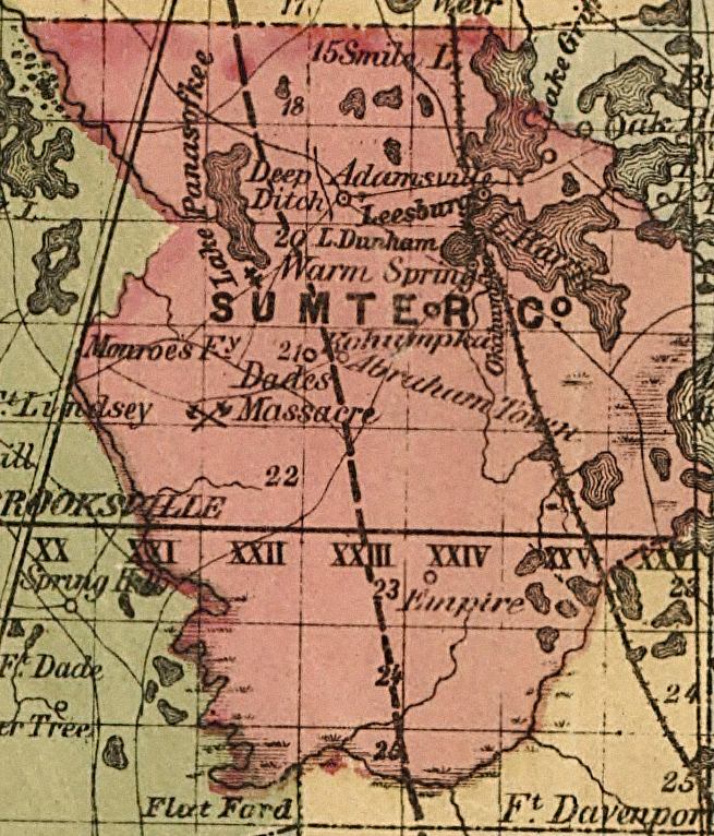
Description: This detail of a map of Florida indicates Sumter County current to 1874. It shows drainage, township and county boundaries, cities and towns, battlefields, and submarine cables to Havana. It also lists operating and newly chartered railroads of the time. Some of the features shown are Leesburg and Dade's Massacre.
Place Names: Sumter, Lake Panasoffkee, Deep Ditch, Adamsville, Leesburg, Lake Dunham, Warm Spring, Lake Harry, Abraham Town, Dade's Massacra, Empire,
ISO Topic Categories: inlandWaters, location, oceans, transportation
Keywords: Sumter County, political, transportation, historical, county borders, roads, railroads, other military, inlandWaters, location, oceans, transportation, Unknown,1874
Source: Columbus Drew, LC Railroad Maps (Jacksonville, FL: Columbus Drew, 1874) 195
Map Credit: Courtesy of the Library of Congress, Geography and Map Division. |
|