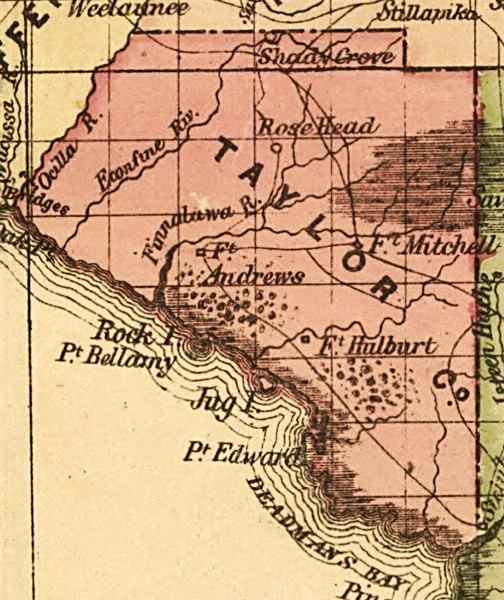
Description: This detail of a map of Florida indicates Taylor County current to 1874. It shows drainage, township and county boundaries, cities and towns, battlefields, and submarine cables to Havana. It also lists operating and newly chartered railroads of the time. Some of the features shown are Shady Grove and Fort Andrews.
Place Names: Taylor, Shady Grove, Rose Head, Ocilla River, Fort Andrews, Fort Hulbert, Fort Mitchell, Jug Island, Rock Island, Point Edward, Deadman's Bay,
ISO Topic Categories: inlandWaters, location, oceans, transportation
Keywords: Taylor County, political, transportation, historical, county borders, roads, railroads, other military, inlandWaters, location, oceans, transportation, Unknown,1874
Source: Columbus Drew, LC Railroad Maps (Jacksonville, FL: Columbus Drew, 1874) 195
Map Credit: Courtesy of the Library of Congress, Geography and Map Division. |
|