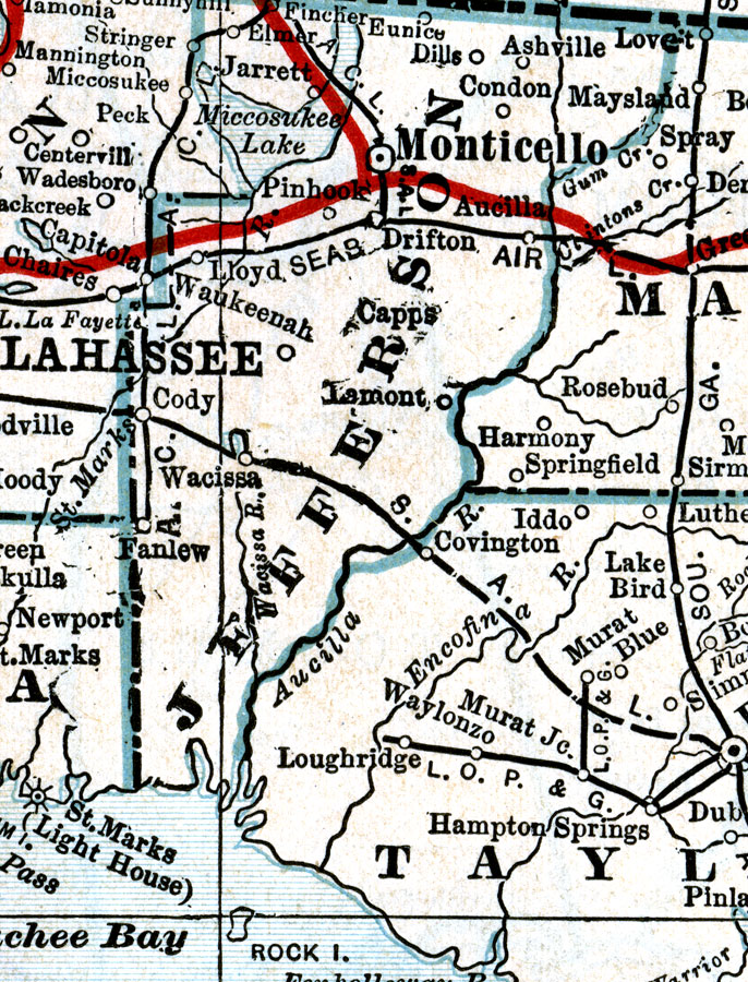
Description: A map of Jefferson County showing county lines, the county seat (Monticello), railroads, canals and principal auto routes connecting the major cities current to 1917.
Place Names: Jefferson, Monticello, Wacissa, Fanlew, Aucilla, Waukeenah, Pinhook, Capps, Lamont
ISO Topic Categories: boundaries, inlandWaters, transportation
Keywords: Jefferson County, physical, political, transportation, physical features, county borders, railroads, roads, boundaries, inlandWaters, transportation, Unknown,1917
Source: C.O. Sylvester Mawson, Geographic Manual and New Atlas (Garden City, NY: Doubleday, Page & Company, 1917) 166
Map Credit: Courtesy the private collection of Roy Winkelman. |
|